-
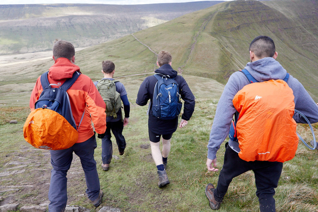
Am I ready for the mountains?
While the mountains can be stunningly beautiful, serene and awe-inspiring on a clear day, weather conditions can change almost instantly and can therefore become dangerous very quickly. As long as you’re prepared and know what to expect, you should be able to stay safe and enjoy your time in these amazing landscapes.
Read on to find out how you can prepare yourself for the challenge and remember to look at the challenge as a marathon, rather than a sprint. These are long distance hikes where you’ll be on your feet for a long time, hiking up steep inclines and putting pressure on the knees on the steep declines. Prepare yourself well and you’ll reap the rewards!
-
How can I prepare for mountain conditions?
Preparation really is key to any hiking challenge, especially those where the terrain, weather and altitude may play a part.
For this reason we offer Mountain Awareness Days for our corporate challenges and we recommend that at least one member of your team, ideally two, have attended this course. In the one-day course, we’ll cover navigation, personal comfort, group safety and emergency procedures.
You can find out more by viewing our Mountain Awareness Day Information.
Dates for your challenge Mountain Awareness Day can be found on your event page.
Please let us know if you’d like to attend by emailing Natalie.
-
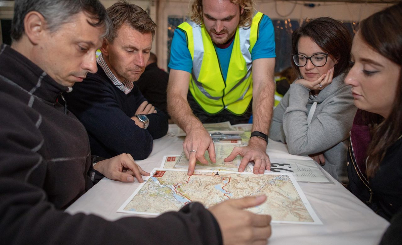
Do I need to map-read?
Although there will be mountain safety cover on all mountains, teams should buy a compass and practice navigating with an Ordnance Survey map. For hill-walking, a compass needs to be accessible at all times – most are supplied with a lanyard to be worn around the neck.
In order to become a competent navigator, we suggest you go through the following list and make sure you can:
- Orientate or set the map in relation to the ground
- Understand contours and their significance
- Make aware of basic map symbols; footpaths, trig points, boundaries, features etc
- Interpret and plot six figure grid references
- Understand the difference between true, grid and magnetic north and how they relate
- Understand the main features and operation of a Silva type compass
- Understand the meaning of bearings, how they are taken and used
- Take a compass bearing from the map and follow it on the ground
- Take a compass bearing on the ground and transfer it to the map
- Find your position from identifiable features (back bearing/resection)
- Estimate distance travelled by timing
- Make yourselves aware of Naismith’s rule
For more information, check out the Ordnance Survey’s map reading guides at https://getoutside.ordnancesurvey.co.uk/guides/beginners-guides-map-reading/ and remember that map reading will be covered on our Mountain Awareness Days, which you are encouraged to attend.
-
How will the Youth Adventure Trust keep me safe on the hike?
The Youth Adventure Trust have been organising and delivering challenge events for over 25 years so we have plenty of experience in supporting participants to reach their goals. We will always provide a Safety Briefing before the challenge begins, a comprehensive registration will cover logistics but also talk you through the route you will be hiking. There are always staff on hand from when you arrive on site to the end of the challenge if you have any queries. At the start line we’ll check your footwear to ensure it’s suitable and check with you to make sure you have compasses, whistles, suitable clothing, route maps and sufficient water and food.
For the majority of challenges the Youth Adventure Trust will ensure there are marshals or radio checkpoints at various points on the route. Teams will either be issued with radios to report in to challenge base, or with trackers so we can ensure you’re en route to the finish. Marshals and Youth Adventure Trust volunteers who are located along the route are usually highly experienced mountain leaders.
Mountain Safety Preparation